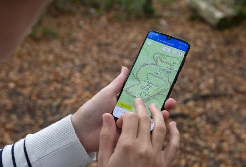
The app "La boussole"
 Aucune date à venir
2h
2h
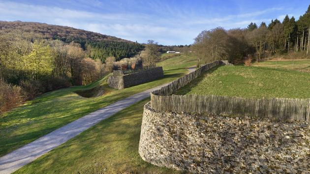
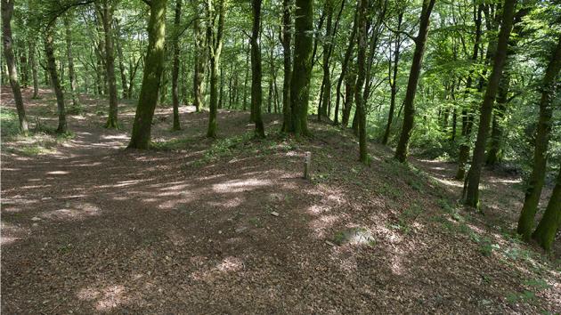
The rampart
After climbing the north-eastern flank of Mount Beuvray, you enter the ancient town through the Rebout Gate. Opened in the rampart that encircled Bibracte, it was the main gateway to the oppidum. After its excavation in the 1990s, part of it was rebuilt using the murus gallicus technique hailed by Caesar: an earthen embankment reinforced by a framework of interlocking horizontal beams, the whole consolidated by a stone facing, and lined with an external moat.
No less than 100 hectares of wood, 10,000 m3 of stone and 50,000 nails were used to build this 5 km long rampart. Surveys have revealed a second, larger and older fortification line in the imposing slopes of the mountain.
The Côme-chaudron
Along the main street from the Rebout Gate there were dozens of metal workshops. These workshops were excavated and then filled in to ensure their preservation, but you can see in the museum a life-size reconstruction of the excavation of one of the bronze workshops, which specialised in the production of fibulae, the large clothing staples.
The path is now lined with twisted trees. In the 19th century, the farmers who grazed their herds on Mount Beuvray laid down and intertwined young beech stems to form living hedges. It is these beeches, which have grown in bizarre shapes, that are known as "queules" and which contribute to Bibracte's fame.
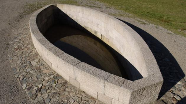
The basin
In the centre of the main road, a basin in the shape of a ship's hull and made of carefully arranged granite blocks testifies to the geometrical knowledge of the Bibracte builders, faithful to the canons inherited from the Greeks. Why was it built in this particular place? How was it supplied with water? What was it used for? The mystery remains to this day.
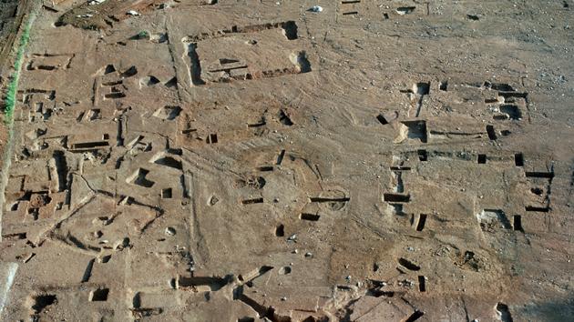
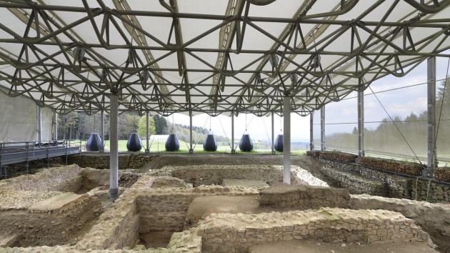
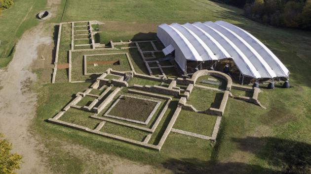
The monumental centre
Built shortly after the middle of the 1st century BCE and heavily altered after a fire in about 20 BCE, this vast space, measuring 100 metres on each side, is a combination of Roman buildings with public areas (shops, porticoed courtyard) and private areas.
In the axis of the main entrance, a building with a roof raised by a colonnade evokes a basilica, a place of public gathering, within what is perhaps the oldest Roman forum on Gallic soil.
It is preserved under a large shelter designed by the architect Paul Andreu, weighted down with sandbags to compensate for the absence of foundations.
The Franciscan monastery
This monastery was established around 1400 and functioned for 300 years. However, it was home to only a handful of Franciscan monks, who were interested in scholarship and agriculture, as evidenced by the artefacts found during the excavations and displayed in the museum. The presence of this convent is probably explained by the presence of the May fairs which gather crowds throughout the modern era.
La pierre de la Wivre
This rocky point is associated in popular memory with the Wivre, the half-woman, half-snake monster of Burgundy legends. To have a chance of seeing her and her treasure, you have to be there on Christmas Eve, between the twelve strokes of midnight, not before or after.
It is also said that it was from the top of this stone that Vercingetorix harangued the Gallic tribes to unite against Caesar, in 52 BC.
The excavation carried out in 2003 revealed that the stone owes its shape to a rock quarry from the 1st century BC.
The large Roman house PC1
Imagine living in a 3,600 m² house. This was the case for at least one of Bibracte's wealthy owners who, strangely enough, had this gigantic house built on the site of a succession of older buildings, just before the town was abandoned for Augustodunum (Autun).
This house has nothing to envy to those of Pompeii: built on the model of the Roman domus, it has an atrium, a peristyle, mosaic decorations and wall paintings, hot and cold baths, sewage disposal and a floor heating system. In short, all the modern comforts!
L’Hôtel des Gaules
Jacques-Gabriel Bulliot, the first excavator of Bibracte at the end of the 19th century, had established a small pied-à-terre on the site. This thatched cottage, rebuilt identically, now houses an exhibition devoted to the first explorations of the site in the 19th century.
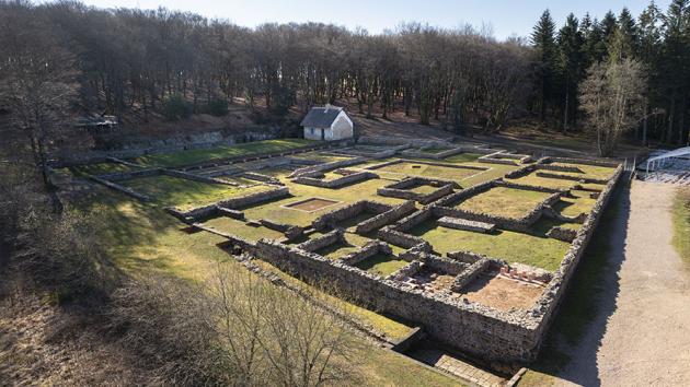
The Roman house PC2
Organised around a central courtyard, this domus has a plan typical of Roman aristocratic houses. Explored by Bulliot in 1882, excavations were resumed in 2016 as part of the school project, in order to clarify its organisation and to understand its relationship with the other buildings in the area.
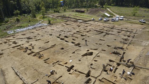
The monumental esplanade PC15
PC 15 is an exceptional architectural ensemble of 45 m on each side, built on an artificial terrace initially retained by a wall using the murus gallicus technique, usually reserved for fortifications. Rebuilt three times, it initially took the form of a courtyard surrounded by galleries on posts, before a central wooden building replaced them. In the last state, stone replaced wood, as shown by an exceptional retaining wall with pilasters made of finely cut granite blocks.
This is probably the first public space in Bibracte that functioned until the town was abandoned.
It adjoins a second, even larger terrace, called PC 14, in the vicinity of a district of large aristocratic residences and below the Theurot de la Roche, one of the supposed places of worship of the oppidum.
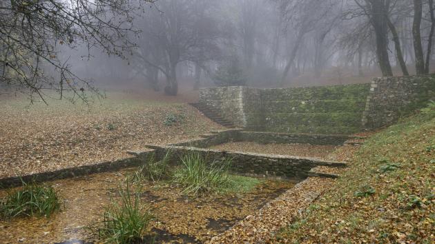
The Saint-Pierre fountaine
Mount Beuvray has a large number of springs. Linked to the most abundant of them, the Saint-Pierre fountain has undergone several very different developments from Antiquity to the 19th century. The reconstruction proposed today after the excavations evokes the basin built in the 1st century BC.
Like many other springs, the Saint-Pierre Fountain has been the object of a popular cult that has lasted. Did you know that in the 19th century, Morvan nurses came to soak their breasts in the fountain to ensure abundant milk?
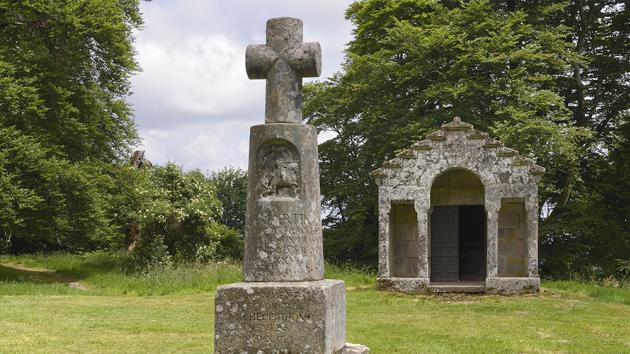
The Chapel of Saint-Martin
Installed on the site of a Gallo-Roman temple, the chapel and the Saint-Martin cross bear witness to the continued religious vocation of the place. The chapel was built in 1873, following excavations by Jacques-Gabriel Bulliot. The Beuvray fairs were held nearby on the first Wednesday in May, according to a tradition that is famous throughout Burgundy.
Nowadays, visitors still leave little votive words of thanks or pious wishes on the altar of the chapel.
La Chaume
At an altitude of 809 m, the most beautiful viewpoint offered by Mount Beuvray, towards the south-east and the Arroux valley, is revealed: on a clear day, you can see the Alps and Mont Blanc!
It is the ideal place to rest on the grass and admire the landscape for long minutes.
Nearby, a monument honours the memory of Jacques-Gabriel Bulliot, who literally "reinvented" Bibracte through his excavations between 1867 and 1895.
Test pits carried out in recent years have revealed evidence of light constructions, probably linked to the great May fairs that made the mountain famous from the late Middle Ages onwards.
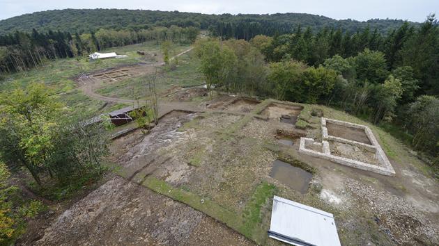
Le Theurot de la Roche
Éminence rocheuse qui surplombe le secteur du Parc aux Chevaux (PC), ses résidences aristocratiques et ses terrasses monumentales, le Theurot de la roche a livré les vestiges d’un probable lieu de culte de forme carrée, qui a fourni la seule inscription en pierre connue à Bibracte. Dans la pente, des fouilles récentes ont mis en évidence une exploitation de minerais métalliques.
Les Grandes portes
Sur le versant sud-ouest du mont Beuvray, à l’opposé de la Porte du Rebout, les deux remparts construits successivement à la fin du IIe et au Ier siècle avant notre ère se rejoignent et offrent aux archéologues l’opportunité d’étudier deux aménagements différents de portes fortifiées ainsi que des tronçons de remparts jamais perturbés par les fouilles du XIXe siècle. Un nouveau chantier de fouilles s’y intéresse depuis 2019.
La nécropole du Rebout
Mise au jour lors des travaux de terrassement préalables à la construction du musée, au début des années 1990, la nécropole du Rebout est la seule connue à ce jour pour la capitale éduenne. Constituée de petits enclos funéraires, elle documente la pratique majoritaire de l’incinération. Les analyses démontrent la modestie et le jeune âge des défunts.
En surplomb, entre les deux lignes de remparts, une tombe isolée se distingue par sa localisation, par son aménagement et par la nature des offrandes funéraires : céramiques d’importation, denrées méditerranéennes et plaquettes d’os ouvragées rappelant les banquettes romaines confirment le statut privilégié de la défunte.